I was looking at renewing my aging handheld GPS unit. When I investigated the prices of new units, I was quite shocked. At about the same time, a chance conversation at a tackle show, lead to me reviewing a Vexilar SP200 Sonar Phone T-box. If you already own a smart phone or tablet, and you are looking for a fish finder or chartplotter for use on a small boat or kayak, then read on, as you may find this of interest…
The unit allows your existing smart phone or tablet to be used as a wireless display for a fish finder and also to display nautical charts using apps. Not only that, but the apps allow you to generate and display a detailed depth contour chart in real time as you are moving around, using a system called Sonar Charts Live.
The system works by using a traditional transducer, which connects to a 12v powered box of tricks (T-Box). The T-box transmits the signal from the transducer wirelessly (using wi-fi) to your smart phone or tablet. The app on the smart phone/tablet displays the sonar recording and the charts.
What’s in the Box ?
When you purchase the Vexilar Sonar Phone SP200 T-box – this is what you will see…
- A transducer
- A wireless T-box
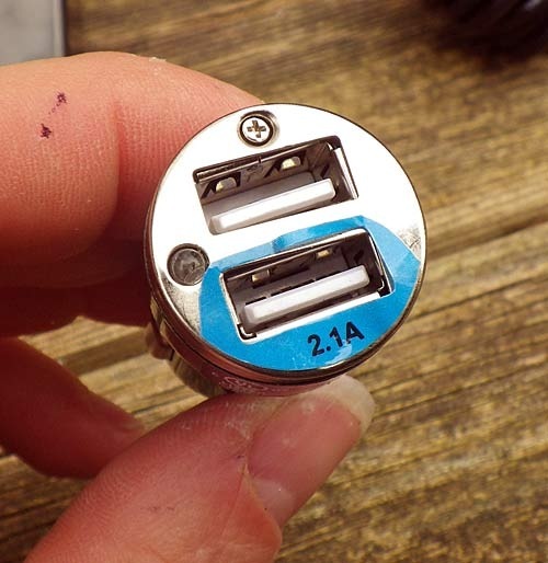
- A 12v to USB adaptor
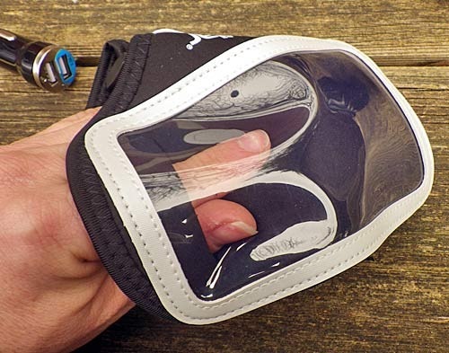
- An armband to hold a smart phone
- Some fixing screws
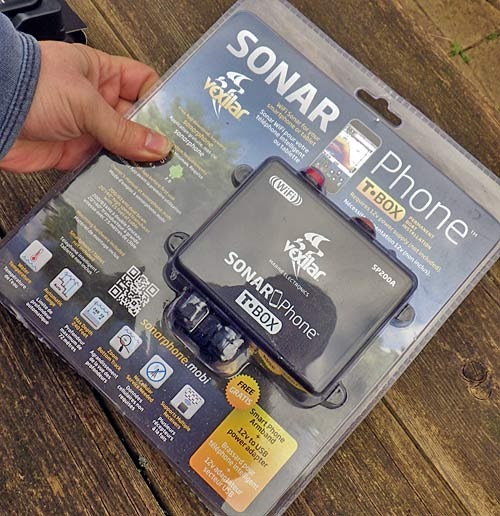
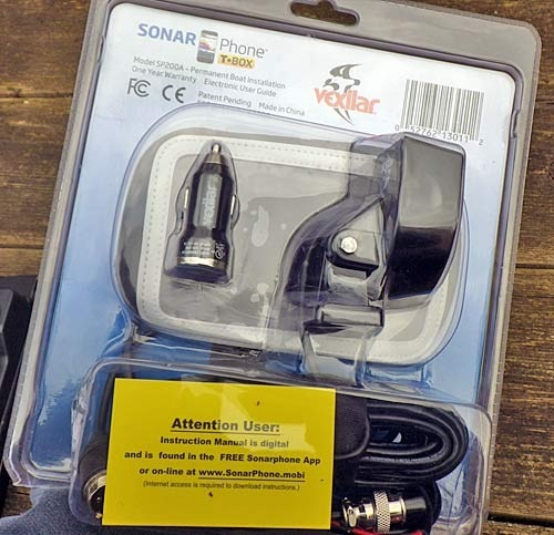
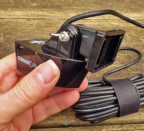
The transducer…
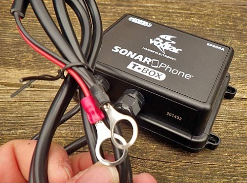
The T-box…
The 12v USB converter…
The sports arm band for smart phones…
This review is primarily concerned with the features, capabilities and operation of the unit. But I have written a detailed installation guide which covers installation…
Installation
I decided to install the transducer and the T-box inside the hull of my kayak, and to power the T-box unit directly from my existing 12v lithium battery set up.
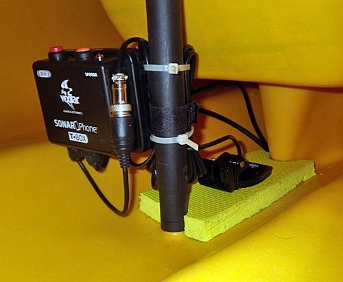
I have written a set of detailed illustrated step-by-step instructions which explain how I installed the equipment on my kayak. Please see the link below…
https://dizzybigfish.co.uk/installation-intructions-for-vexilar-t-box-sonar-phone-sp200
Operation
This review will mainly cover operation using an iPad mini (with some reference to operation on an iPhone). I am using a waterproof iPad mini case, and ruggedised RAM mounts to secure the iPad for use on the kayak.
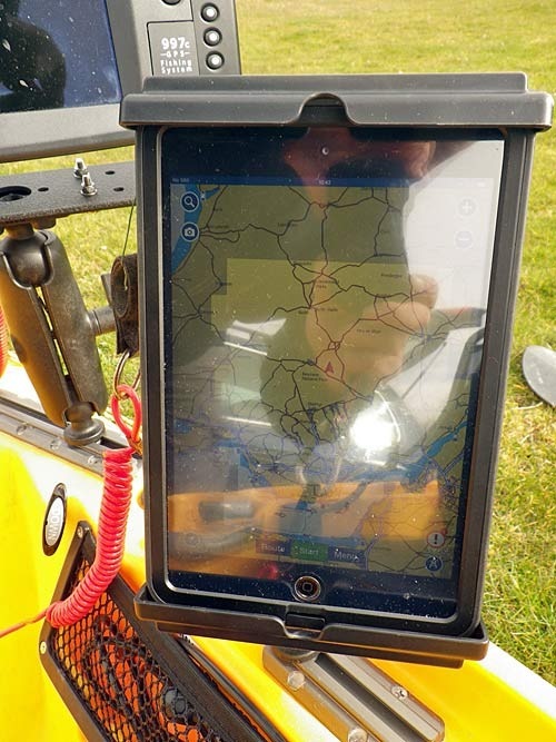
Note : If you wish to use an iPad for displaying your location using the Navionics app, be aware that only the Cellular iPad models have the GPS capability.
There are several apps which you can use with the T-box (for android and iOS), I will be concentrating on 2 apps which I used…
- Sonar Phone App
- Navionics Boating App
When the T-box is switched on, it creates a wi-fi hotspot. You need to connect to this from your iPhone or iPad in order to use the apps below.
Sonar Phone App
SonarPhone is a FREE app. I installed it on both my iPhone and my iPad mini. When the app first starts, it gives you the choice of either running a demonstration (simulator) or connecting to the T-box (live). In terms of look and feel, the demonstration mode is identical to the live mode…
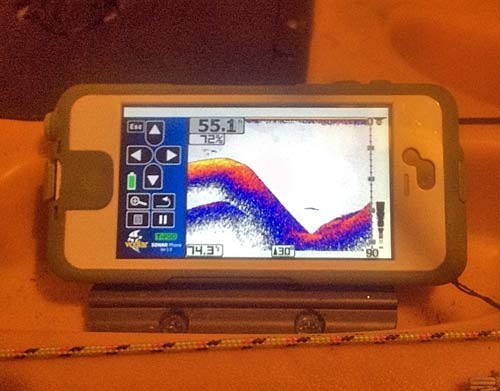
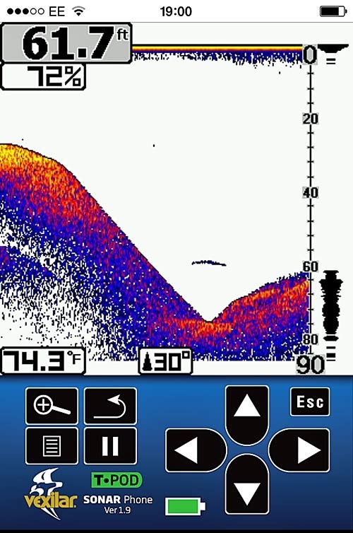
The display provides controls and options which can be used to customise the settings to optimise the display for differing conditions. You can change the angle of the transducer cone from narrow to wide (40 degrees), and you can also display a secondary (smaller) overlay window which magnifies the detail shown – useful for showing a zoomed version of the seabed. You can also change the gain (sensitivity) of the returns. This is probably the most useful feature, and its easy to update using the options. The gain value is displayed at the top of the screen just underneath the depth readout.
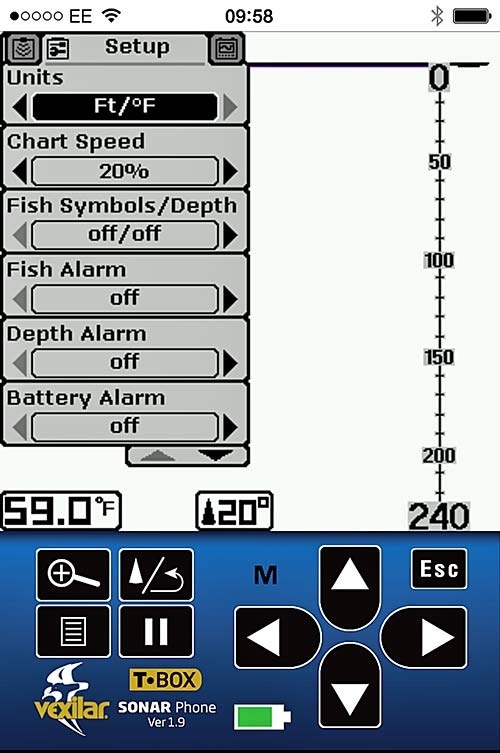
Th SonarPhone app looks a little bit clunky on the bigger iPad display (its really designed for use on the iPhone) – but its not a problem.
Navionics Boating App
You can buy the Navionics Boating app for an iPhone for about £25, depending on the coverage area you are interested in. I was using the HD version for the iPad, which also includes the Sonar Charts Live functionality, again, it depends on the map coverage (I was using UK and Holland), but the price is about £50.
The Navionics Boating App HD, contains a great deal of functionality…
1. It displays detailed Navionics nautical charts for your selected area in great detail
2. It acts as a plotter/GPS, showing your position, and allowing you to set markers (waypoints) and routes. It also lets you record tracks.
3. If you are using the SonarPhone T-box (as I am), then the latest Boating app HD will display your fish finder split screen within the same window (like having the SonarPhone built into the Boating app)
4. Using the depth returns from the T-box, the app uses functionality called “Sonar Charts Live” to display detailed depth contours on top of your existing Navionics chart in real time – very cool !
5. The app also allows you to display tidal stream information – you can see tide heights and tide directions; again this is very useful.
Rather than going through every feature in detail, as a fisherman, I will concentrate on the things which are most interesting.
Perhaps the app’s most important feature, is the ability to display both the charts and the fish finder in a single split screen display(effectively turning your iPad into a fishfinder/plotter combo,complete with Navionics charts – COOL !)…
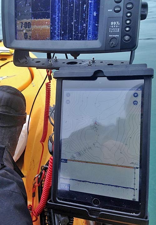
Thought the image above is not great, you can see the Navionics chart in the top half of the iPad display, and the fish finder (sonar) display in the bottom half of the display. If you touch the fish finder display, you can either access options, or minimise the sonar display into a small window in the bottom left (this maximises the chart display). Again, the options are comprehensive – and you get quick access to allow you to adjust the gain control (the most useful setting).
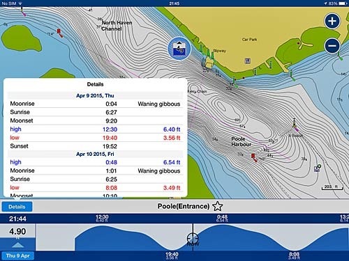
Looking at the charts, and selecting the tidal symbols, throws up a similar window at the bottom of the display. For tidal times and heights (running your finger along the graph at the bottom updates the values and scrolls the graph)…
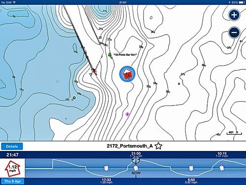
Doing the same thing for the tidal direction sysmbol, shows a graph showing tidal stream direction. Moving your finger across the time axis on the graph updates the tidal direction arrow on the map, showing you visually the direction of the tidal stream…
Perhaps the most ingenious feature of the Navionics Boating HD app, is the ability to create your own detailed depth contour map, and display it in real time. This is referred to as “Sonar Charts Live”. I decided to try it out on the kayak.
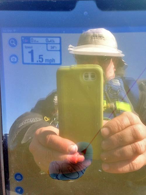
When you press the icon in the bottom left hand corner of the screen, you are presented with some options for displaying charts. The default is to display the standard Navionics chart. The other options allow you to record and show “Sonar charts”. These are charts which use data which has been recorded by fishfinders, so they are quite detailed. You can record your own chart using the “Sonar Charts Live” option. When this option is selected, the app displays and logs the contours in real time as you are moving around. The chart display shows a snail trail which is overlayed on the chart as you move. The image below shows me taking a picture of the iPad screen, displaying the Sonar Chart live data on the iPad screen…
Using this feature, you can either augment, or improve the resolution of your existing Navionics charts, or create completely new charts for areas (lakes etc) which maybe are not currently covered by the Navionics charts.
To test this out, I decided to paddle around an existing area, and build up some sonar chart live data. Then I compared the level of detail of the pre-existing Navionics chart with that just created with the Sonar Charts Live feature.
This is a snapshot of the standard Navionics chart, showing the trck of me paddling in a criss cross, but without the sonar charts live data overlayed….
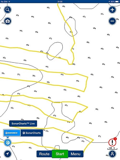
And the same chart with the Sonar Charts Live layer switched on…
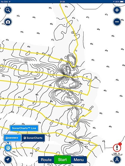
As you can see, the Sonar charts live overlay has increased the resolution of the contours, and made a big difference to the quality of the map. Remember, this is all performed and displayed in real-time, as you paddle around.
Once you get home, and connect your iPad to the internet, you have the option of uploading the chart you have created to the wider community. Doing this, will make your updates visible to other people who select the “Sonar charts” option. If that was not clever enough, Navionics also provide an option to convert data logged from existing third party fish finders such as Lowrance, Humminbird, Raymarine etc. This means that even if you do not own a Vexilar T-box, you may still be able to use your existing fish finder to record and upload data to Navionics Sonar Charts. Then you can still view your chart using the Sonar Charts option on your Navionics Boating app, or if you have a Navionics+ chart card, you can download the Sonar Charts to the card and view them on your existing fish finder. Now that is pretty neat !!!
Conclusion
I used the Vexilar T-box and Navionics Boating app HD in conjunction with my Humminbird 997c side imaging sonar, and ran the 2 units side by side as a comparison. Obviously, the 997c is a high end unit, but in terms of the 2D sonar, the units were not that different – and in terms of the Navionics chart display, the iPad’s bigger display definitely had the edge, and also you have the added bonus of a touch screen too.
Pros
If you already own a tablet, then the Vexilar T-box/Navionics app combo is a great option in terms of cost and functionality
The ability to create your own detailed charts in real time using Sonar Charts Live, is a great feature for fishermen
Having a wireless plotter/fish finder is a great bonus on a kayak – no transducer or power leads need to be passed through the hull
The Vexilar T-box draws very little current (25mA) – so the box will run for a long time using an existing 12v battery
Interacting with the sonar/charts using the iPad’s touch interface is easy and quick
Cons
Battery life on my iPad mini when using the Navionics app, was not great – this is not a reflection on the Navionics app or the Vexilar, but its worth bearing in mind that you will need a top-up if you plan to be afloat all day
Waypoint management needs to be improved. The Navionics boating HD could be a real killer-app, if it provided the ability to import waypoints (fishing marks) from your existing GPS units, and provided a better facility to manage them using the app
In short, if you already own an iPad or tablet, then the Vexilar T-box and Navionics Boating app HD is a great option in terms of both cost and features, when compared to buying a separate fish finder/GPS unit. You get a fish finder, a plotter, Navionics charts and the ability to define your own charts in a wireless package using a touch screen interface – what more could you want ?…. What’s that I hear you say ? Will it catch me more fish ? Maybe ![]() ….
….
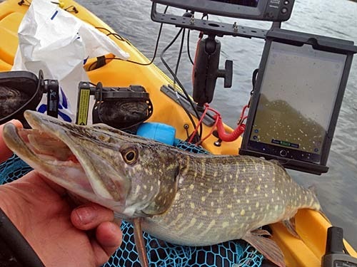
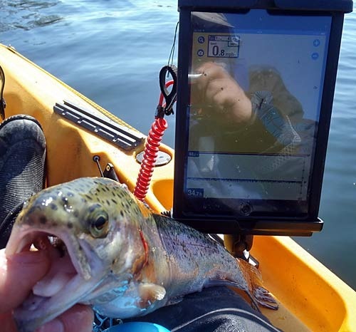
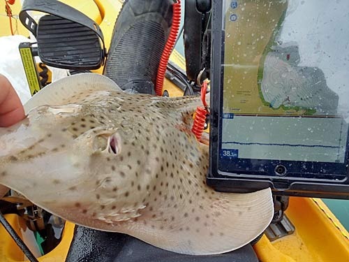
For more information on the Vexilar T-box Sonar Phone or the Navionics Boating apps, please see the following websites…
